
Background
We worked with Earth Networks on product redesigns, iterative feature enhancements, and new product concepts over multiple years leading up to their acquisition by AEM, as well as afterwards. Their technology helps organizations make time-sensitive decisions when severe weather threatens people and operations. Powered by a global lightning detection network and thousands of professional-grade weather stations, their data supports safety decisions for airlines, stadiums, school districts, and emergency management teams.
Their web platform, Sferic Maps, gave operations and safety staff a capable command center for monitoring threats. But as Earth Networks evolved into a modern SaaS business, some gaps became clear. Their current platform was outdated and relied on manual workflows, which made it hard to keep pace in an evolving alert and safety-driven market. The product catered to a user sitting at a desk, while the people responsible for safety were increasingly in the field, moving between sites, and managing multiple locations at once.
Discovery
We began with the people making weather-based decisions under pressure. Working alongside the Earth Networks team, we interviewed enterprise customers across the sectors most central to their growth: emergency preparedness, business continuity, and live-event operations.
The interviews surfaced a consistent story. Customers deeply trusted Earth Networks' data and meteorologists, but the surrounding experience made that data harder to act on than it needed to be. A business continuity director toggled between her phone and laptop throughout a storm, often rewriting and reorganizing forecast content by hand so her own teams could read it quickly. An emergency coordinator kept legacy tools open on office monitors all day because the dashboards buried what he needed under content that felt like advertisements. Sports operations staff took screenshots of radar on their phones and pasted them into Slack, and wished the lightning "all clear" was a simple, user-friendly countdown instead of a manual check.
A few themes rose to the top:
- Cross-device and mobile support was weak, yet critical for staff who are on call, in the field, or moving between locations on game day or during an event.
- Sharing and distributing forecast information was clumsy, pushing customers to copy, paste, and rebuild content in their own emails and tools.
- Alerting needed to be modern and configurable: GPS-aware, threshold-based, and tied to the actions teams actually take.
- The dated, manual meteorologist workflows were both a customer experience problem and an internal efficiency problem.
Underneath the specific requests was a bigger strategic goal for Earth Networks: modernize the experience across web and mobile, consolidate overlapping legacy products, and build a world-class experience for high-value enterprise clients that could scale to other segments over time.
How We Did It
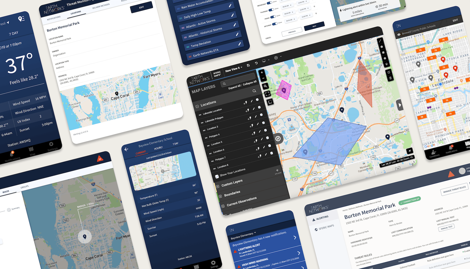
We worked as an embedded extension of the Earth Networks team, pairing product strategy with UX/UI design. Sferic Maps needed iterative feature innovation, while stabilizing as the configuration and monitoring hub. Sferic Connect was created as the mobile experience to put alerts in people's hands.
Our work to launch Sferic Connect:
- First, we conducted customer interviews across Earth Networks' priority enterprise sectors to understand how teams monitored conditions, set thresholds, and communicated during live weather events.
- Then we mapped those workflows to identify where a modern experience would reduce friction and manual work, such as email & spreadsheet reports, forecast entry, and on-the-field team communications.
- Next, we designed and prototyped a unified vision spanning desktop and mobile, walking though real scenarios (a business continuity director facing an incoming snowstorm) end to end so stakeholders could feel the experience, not just review screens.
- We transferred the prototype into high-fidelity, developer-ready handoff artifacts, translating threat and alerting logic into a focused mobile experience with location-aware notifications.
We also strengthened core feature sets for Sferic Maps. This included Horns & Strobes configuration for on-site physical alerting, Lightning Reports for reviewing and documenting activity, and Threat Monitoring for defining the location-and threshold-based rules that determine when an alert fires across platforms.
Throughout, we built on the MUI design system to modernize both the interface and the underlying experience, and to establish a consistent, reusable foundation across the two products. Because Earth Networks also deploys physical alerting hardware, part of the work meant bridging the digital and physical, which involved designing controls clear and dependable enough for equipment that triggers a real horn or strobe in a real place.
Impact
Our engagement ran from discovery through high-fidelity developer handoff. We shaped the strategy, the workflows, and the designs that defined both products, then handed a build-ready foundation to Earth Networks' development team.
The result was a connected product ecosystem. Sferic Connect launched in June 2019, extending Earth Networks' weather intelligence to the people who needed it most such as field staff, on-call leaders, and teams managing safety across many locations. Strengthened rules-based features in Sferic Maps gave those alerts a dependable foundation. Together, they moved Earth Networks past a desk-bound, manually maintained experience and toward the modern SaaS product their enterprise customers expected.
That work helped Earth Networks secure and support large enterprise clients across aviation, stadiums, and other public safety sectors. And the MUI-based design system left them with a consistent, extensible interface foundation to build on as their portfolio grew.
The partnership continued from there. Scenic West went on to support future UX initiatives with Earth Networks' umbrella company, AEM, bringing along our expertise in the emergency alerting and safety sector.